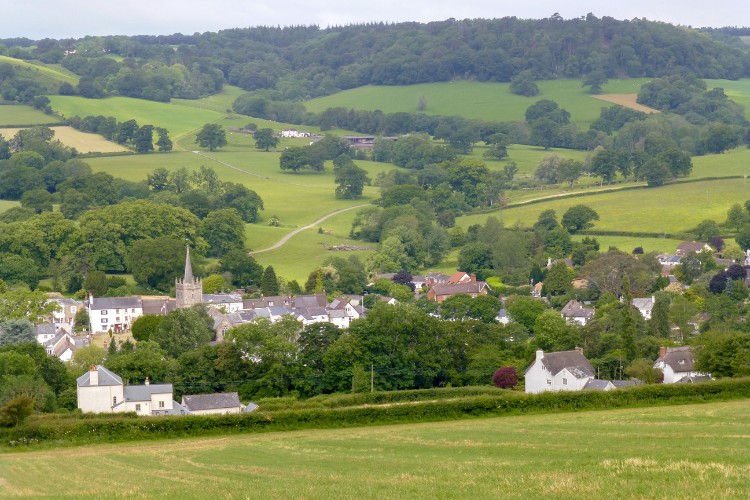
Explore the Coly Valley along footpaths, green lanes and quiet roads. The walk starts near the field where a crock of gold was supposedly found and passes through the village of Farway with its thatched cottages.
There is a field nearby known as the Money Acre where, according to a local tale, Humphrey Hutchins ploughed up a crock of gold. He donated some of the treasure to the church for the rebuilding of the north aisle. Money Acre Cross can be found at the top of the hill to the east of the village of Church Green.
Additional Information
A landscape of history
St Giles church in Northleigh has features, a Beer stone font and an archway over the south door, that date back to Norman times, although it is not known whether they were from an existing church on the site or were brought in from elsewhere. The current church dates back to the late 14th century with additions in the 15th and early 16th centuries.
The tower has gone through several transformations. Originally rendered, the outer coating was removed during a time of Victorian renovation and improvements. However, the tower then became rather damp inside with moss and ferns growing from the stonework. At the end of the 20th century the decision was made to re-render the tower which changed its appearance once again, but has allowed it to dry out.
Inside St Giles has a rich collection of late 15th century woodwork. The oak benches in the nave have beautifully carved ends with a variety of intricately designed carvings within foliage borders. The early 17th century pulpit has lovely carved panels including a traditional frieze of acanthus flowers and scrollwork.
Heard, but not often seen, the church has Devon’s only complete ring of pre-reformation bells, one of the few such rings in the country.
Directions
1-5. Go into the churchyard and take the path around to the left of the church.
Follow it down to a gate out into a field. Go through the gate and follow the hedge on your left down to a stile.
2.Go over the stile to a minor road and turn right.
3.At the next road junction keep left and follow the road to Farway Cross.
4.Turn left and follow the road uphill. Just before the phone mast turn right along a track.
5.Where the track divides, keep right following the track north of Ball Hill.
6 - 10. Continue to follow the track down the hill until it eventually becomes a narrow road
Follow the road around until you come to a road junction.
7. At the road junction bear left and follow the road to Tricombe Farm.
8. Go straight through the farm with the house on your right and follow a track up the hill. This can be wet, muddy and rough in places.
9.Continue to follow the track around a steep bend to a junction of tracks.
10. Turn left and follow the track uphill, around and out through a gate to a minor road at Baker’s Gate.
11-15. Turn right, cross the road and look for a kissing gate on the left.
Go through the gate and head diagonally right across the field towards a woodland.
12. Go through a gate into the wood and follow the path through the trees and out over a stile into a field. Continue straight on across the field.
13. Keep to the left of the hedge and follow the footpath out over a stile to a minor road. Turn left and follow the road downhill. Just after a right hand bend look for a footpath on your right along a track.
14. Follow the footpath along the track ignoring the footpath on your right. Where the track divides keep right passing a house on your left and continuing to a field gate.
15. Go through the gate and follow the footpath left down the field and through a gap into a second field. Head straight down to a narrow footbridge.
16-20. Go over the footbridge and a stile shortly afterwards and follow the footpath uphill alongside the fence on your right to a stile out onto a minor road.
17. Turn left down the road towards Collins Farm.
18. At the T-junction turn right and follow the road for a short distance until it swings around to the left by Northleigh Village Hall. Look for a footpath sign on your right.
19. Go over a stile and follow the footpath straight across the field to a wooden kissing gate. Go through the gate and turn left to follow the footpath alongside the hedge on you left.
20. Follow the footpath uphill going through another kissing gate and up to a stile out onto a minor road.
21. Go over the stile and turn left along the road.
After 164 yards/150 metres take a footpath on the left past the cottages and gardens back to the church.
This route was originally developed by James Baldwin and checked by Ted Swan. It was reviewed and updated in 2025.