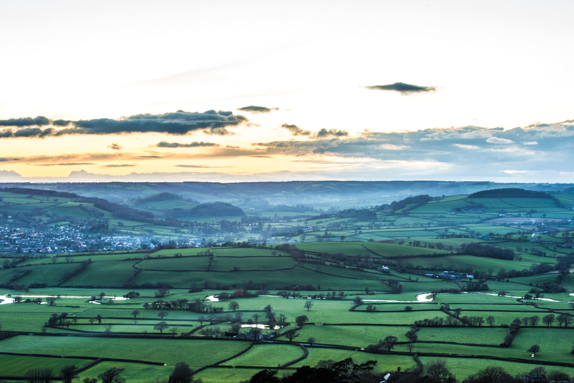
Starting and finishing in Colyton this routes takes you on a journey through the valleys of the Umborne Brook and the River Axe and a range of hidden habitats including watermeadows, fields, woods and unimproved marshy areas rich in wildlife.
You will pass the historic Shute Gatehouse before climbing over Shute Hill and enjoying wonderful views out across rural East Devon
This walk is circular walk 11 as part of our East Devon Way Circular Walk series.
Additional Information
A landscape of history
Colyton, now a market town with a range of shops and places to eat, was reputedly one of the first Saxon settlements established in Devon. It is known as ‘the most rebellious town in Devon’ due to the 105 local men and boys who supported the Duke of Monmouth in the Monmouth Rebellion, a plan to overthrow the King James II in 1685.
The main building of the church of St Andrew’s, in the centre of Colyton, dates back to the 15th and early 16th centuries, while the tower is 12th century with an unusual octagonal lantern top stage sitting on top. During renovation after a fire in 1933, a late 10th century cross was found, which now stands beside the font.
The Elizabethan Shute Gatehouse watches over the entrance to what is left of the medieval and Tudor house at Shute Barton. It is thought to have been built by William Pole who purchased the Shute estate in around 1560. Now leased by the Landmark Trust and available to rent as holiday accommodation, it rather unusually has a Jacobean plaster ceiling recycled from a house that was demolished in Barnstaple in the 1930s.
Important wildlife
Look out for wetland flowers, particularly in the unimproved areas, including orchids and kingcups. The area also supports many birds and mammals that favour woodlands, hedgerows and river margins. Prints in patches of wet mud will give you an idea of what has been there before you, maybe a wader or even a badger. If you’re particularly lucky you might spot the ghostly shape of a barn owl hunting over the fields and wetlands during the day.
Directions
1. The walk starts from the pay and display car park in the centre of Colyton
From the car park entrance go straight across Dolphin Street and follow Silver Street through to Market Place. With St Andrew’s Church on your right, carry straight on into Vicarage Street and follow it around ignoring all side turnings until you come to the T-junction with King Street.
2. Turn right and cross Chantry Bridge before forking right towards Umborne
Pass Road Green Farm and look for a footpath sign on the right.
3. Climb over the stile into a field and head slightly left to a pair of metal pedestrian gates on either side of a farm track.
Go through the gates and head diagonally to the left of the telegraph pole down to the bottom left corner of the field.
4. Turn left and go over the stile and ditch boards
to follow the path alongside the field edge on your right.
5. Go through the gate into the next field
and follow the right hand hedge until you come to a stile on your right into an area of woodland. Go over the stile and turn left following the path over a ditch board to reach a footbridge over the Umborne Brook.
6. Go over the bridge and head diagonally left across the field to a stile in a wire fencethe road
Climb the stile and continue diagonally left across the next field to another footbridge.
7. Cross the footbridge and follow the hedge on your right to a stile into another field
8. Head diagonally left along the footpath with the brook on your right
following it around until you come to a footbridge.
9. Go over the footbridge
and turn left through an uncultivated marshy area rich in wildlife to reach another footbridge.
10. Cross the footbridge into another field
and go diagonally left heading for a gap near the top of the left hedge. Go through the gap and onto a concrete drive.
11. The public footpath goes left along the drive
and to the right of the farmhouse, before bearing right to a gate into a field. From there bear diagonally left to a stile into woodland.
An alternative route goes straight across the concrete drive and over a stile into the field. From there head straight on, keeping left of a large oak tree, to the stile into woodland.
12.Turn left up the hill and follow the road to another T-junction.
Turn right and follow the road for approx 470 yards/430 metres along the edge of woodland to find a bridleway on your left.
13. Turn left up the bridleway
and follow it ignoring all side paths until you come to a T-junction with a wider forest track.
14. Turn right along the forest track
and follow it ignoring all side turnings until the track flattens out and you come to a bridleway along a track on the right. Turn right along it.
15. Continue to follow the track, then just before the gate turn left
along the narrow bridleway back into the Nature Reserve. At the junction of paths by the bench you can either go straight on and retrace your steps to the car park, or turn left and follow a different path taking the first right by some wooden rails and continuing to the car park.
This route was originally developed by James Baldwin and checked by Ted Swan. It was reviewed and updated in 2025.