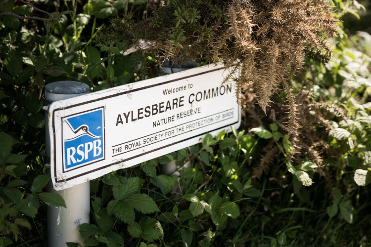
Explore a scenic walk through Aylesbeare Common Nature Reserve, crossing the River Otter.
Pass through Harpford Wood, looking for Victorian railway remnants, and enjoy panoramic views at Fire Beacon Hill before dropping into Sidbury village.
Additional Information
Additional Information Subtitle
The whole of the East Devon Way has been waymarked with the foxglove/pink arrow markers to help you find your way.
Gallery
Quick view route description:
1. From Joney’s Cross car park, cross over the A3052 (SY056 898) into the Aylesbeare Common RSPB Nature Reserve.
Follow the private tarmac track which leads downhill with trees on either side. Turn right off the track onto the woodland path, going down into the valley.
Cross over the stream by the small wooden footbridge. Follow on the track until you get to a building, turn right and carry on down the lane past a tiny thatched building on your left.
2. Just before the lane (SY075 900) turn sharp left (N), up over the fields.
At the next lane corner turn right (Southerton SY 076 903), along the narrow road to Brooklands Cross and on through the fields (E) towards the River Otter and through the orchards.nde, a National Trust 18 sided property on your right. You can stop to enjoy the views from the gardens.
Short detour into Newton Poppleford: A short diversion south into Newton Poppleford will give you access to pubs, shops toilets and local services.
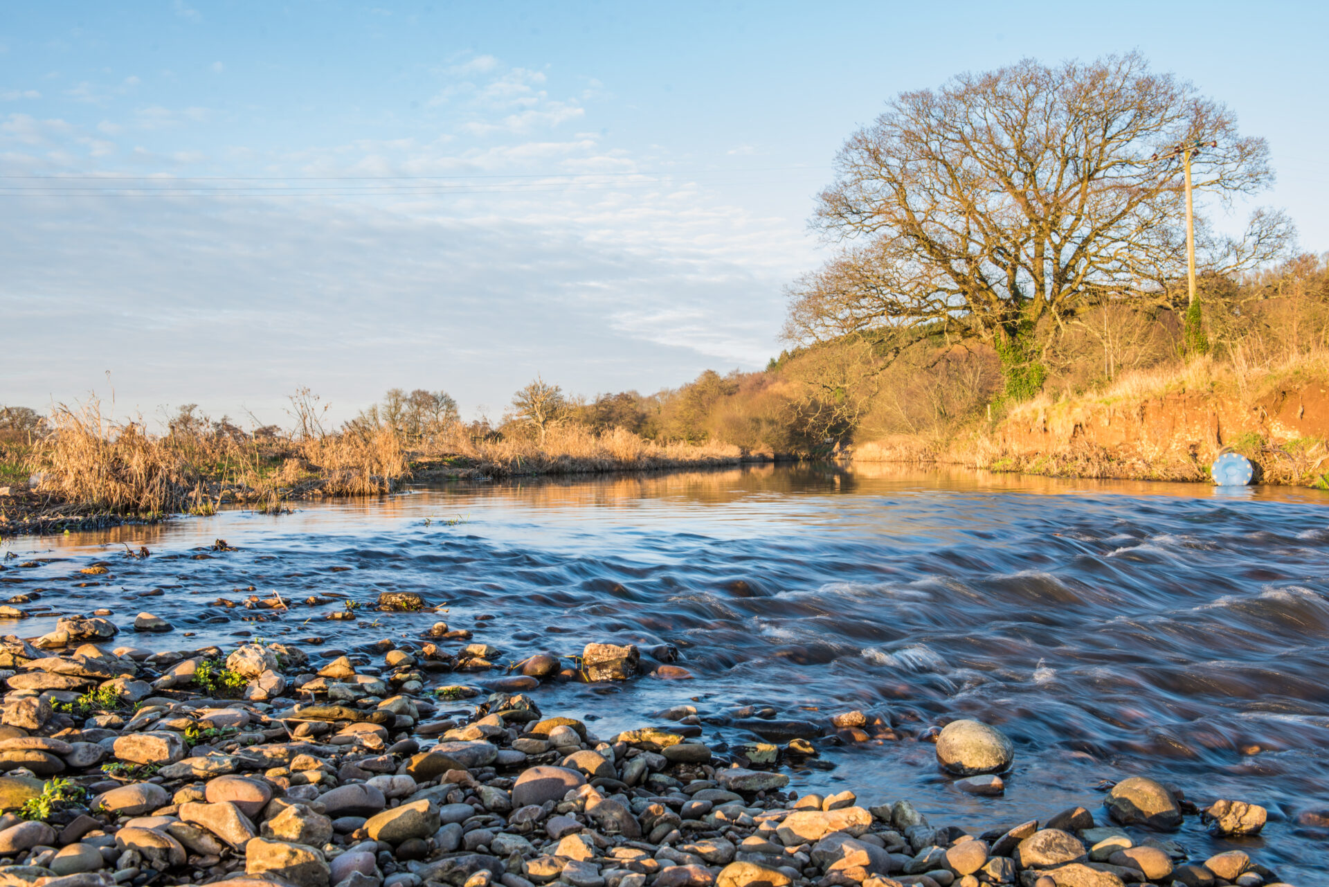
3. Cross the River Otter over the metal footbridge (SY089 903) marked Harpford Bridge on map.
Turn left along the lane towards the Church, there is a brook on your right hand side.
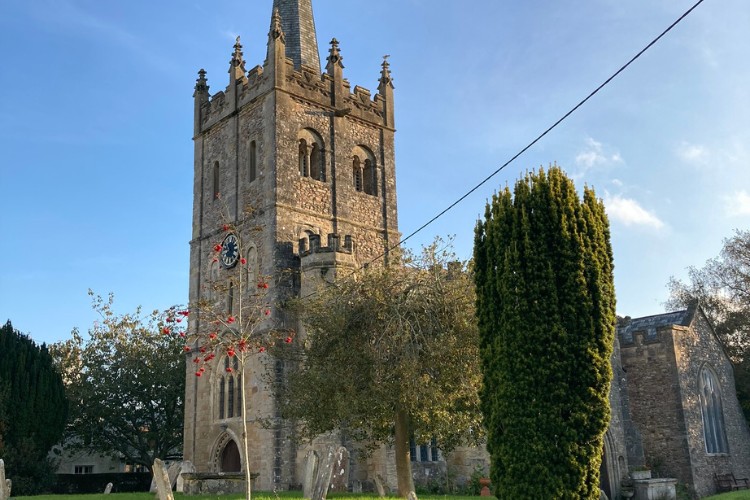
Go past a large white house, named Court Place, on your left and past St Gregory’s Church in Harpford Village. Past the church, turn left along Higher Way for a few yards before turning right up Knapps Lane with Peak House on the corner. Carry straight on down the track, do not continue left on the road.
4. Follow this track until you reach another kissing gate to enter Harpford Woods
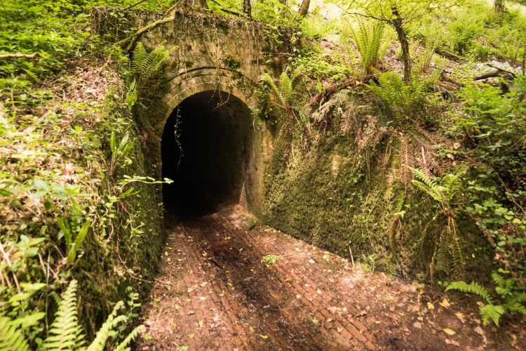
Follow to the left of the sandstone gulley with a stream running through the woods. Pass a brick-lined drainage and access tunnel, go straight up this path, away from the brook.
Walk underneath the old Victorian railway bridge. Head straight on (NE), the path leads up a slight incline, with a little gulley on your right. At the top of the path through the woods take a right towards the little road, B3176.
Pub detour – after the tunnel, take a hairpin bend left and it will lead to the Bowd Pub, a thatched pub on the A3052 road. Check opening timeson the day of your walk.
5. Cross the B3176 road (SY105 907) and go up through the metal gate of Woods Farm, part of the Donkey Sanctuary.
Go straight up the steep incline to Beacon Hill, aim for the stile in the centre of the field at the top near the woods.
Go over the stile and up the steps into the woods, turn right along the tarmac lane for 100yds then left to up on to the steep stony track with a tall wooden fence, which is also a bridleway.
At the Nature Reserve sign take a hair pin bend up left and as the path winds round follow it up to the right. You reach the top of Fire Beacon Hill where the views are spectacular.
6. Carry straight across Fire Beacon Hill Local Nature Reserve (LNR) on Harpford Common see power lines on your right, heading towards White Cross (marked on the map).
Go through the nature reserve metal gate and along the woodland track, wide enough for a vehicle it gently leads downhill for about ¾ mile until ‘White Cross’ where there is a small car parking area.
Cross over the tarmac lane then over the stile into the field keeping the hedge to your left. Turn right across the field towards the wooded copse in the dip in the centre, keep to the left of this, walk underneath the pylons to the metal gate which leads on to a steep sided escarpment with gorse and a woodland on your right.
7. Staying left, come to a line of trees and walk down diagonally right across fields to a gate, then turn left down a farm track which can get muddy.
Pass Goosemoor Farm, a thatched building on your left, and down an asphalt farm track. Turn right to cross over the bubbling brook. Take a sharp left through the field, through a metal gate.
At the end of that field take a left along the edge of the field, you will see white houses to the right. At the gatehouse, cross the entrance drive to Sidbury Manor and enter Sidbury village centre, with its shop (in the butchers) and Red Lion pub.