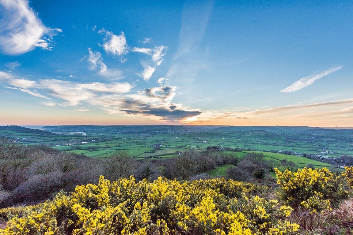
This is a varied landscape walk, that promises a memorable walking experience filled with nature’s beauty.
From Sidbury you’ll rise to see panoramic views at Fire Beacon Hill, pass through Harpford wood, with remains of a Victorian railway line, cross the River Otter and finish at the wildlife-rich Aylesbeare Common Nature Reserve.
Additional Information
Additional Information Subtitle
![]()
The whole of the East Devon Way has been waymarked with the foxglove/pink arrow markers to help you find your way.
Gallery
Quick view route description:
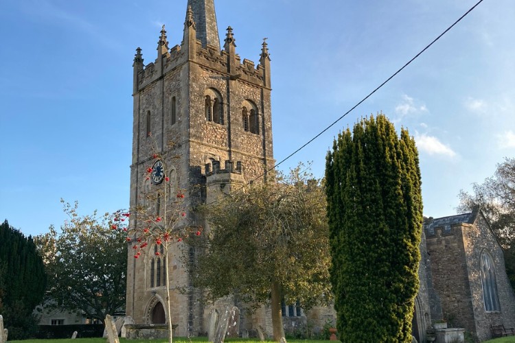
1. Starting from the free car park behind Sidbury Village Hall (on the other side of the road to the butcher and church)
…pass the Red Lion pub and just after the stone wall (where you rejoin the East Devon Way) turn right along the footpath signed to White Cross.
On your right you first pass Court House with its stone mullioned windows, then the stone pillars and black-and-white gabled gatehouse to Sidbury Manor. Walk straight on, with some thatched white cottages away to your left, and soon reach a field gate. Go through the gate and follow the hedge on your right.
At the far corner of the field, follow the footpath sign to the right, pausing for a moment to look behind you at the pine-covered hill behind Sidbury. Go through the metal gate and turn right on to a lane.
This lane becomes a track after it crosses a babbling brook where you keep to the left. Passing the thatched Goosemoor Farm on your right, continue ahead through a gateway on a track hedged on both sides, which can be muddy.
At a gate continue straight on uphill through the centre of a large field. After the next gate go diagonally left across the field towards the line of tall pine trees at the brow of the hill.
Now walk along a track with a wire fence on the right. At the next gate go straight on, keeping a small copse on your left, then at the end of the copse continue straight ahead to go through a gate and reach a lane.
2. Cross over the lane and go left into the Forestry Commission woodland.
This is White Cross, with a small car park area, in early spring you will see a carpet of bluebells in this woodland. Follow the track for ½ mile past Hollow Head Cross where, shortly afterwards, bear right at a fork.
Go though a gate on to Fire Beacon Hill Local Nature Reserve on Harpford Common and take the left fork by the interpretation board and continue on the plateau with distant views of the sea. Start to descend, following the track – which is fairly steep and rocky – down then round to the left.
Short detour: As the path starts to descend at the edge of the hill, turn left where there are benches to admire the view, which is a fine spot for a picnic.
3. As you continue down the hill, look out for a Nature Reserve notice board on your left and here turn sharp right on a more level path.
At the bottom, turn right on to a lane, and shortly take the footpath left down some steep steps through a gate into a field (here donkeys graze from May – October; please do not feed them).
Walk down this steep field, keeping the field boundary to your right, aiming towards the gate at the bottom, that leads to the B3176 road (SY105 907).Take care as this road can be busy. Cross over into Harpford Wood owned by Clinton Devon Estates.
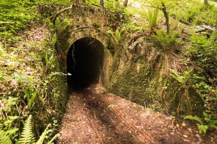
4. Once in the wood you will soon discover the Victorian old railway bridge.
As you walk underneath head towards a sandstone gulley with a stream, which runs through the woods. Whilst walking through Harpford Woods look out for deer and other wildlife..
Pub detour – after the tunnel, take a hairpin bend left and it will lead to the Bowd Inn Pub, a thatched pub on the A3052 road. Check opening times on the day of your walk.
5. You will pass a brick lined tunnel as you follow the path through the woods.
At the end of the woodland track you will exit the woodland and reach a kissing gate which leads you on to Knapps Lane.
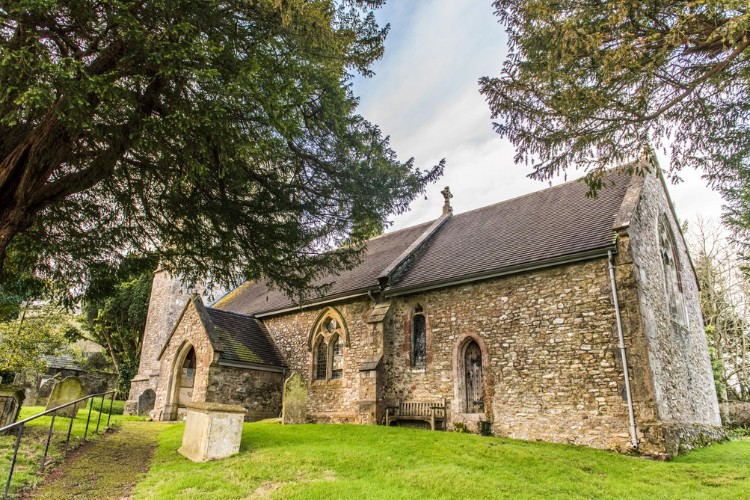
As you walk slightly downhill, after a few yards turn left towards St Gregory’s Norman Church in Harpford Village and after a few yards turn right keeping the Church on your right and pass Court Place, a grand white house.
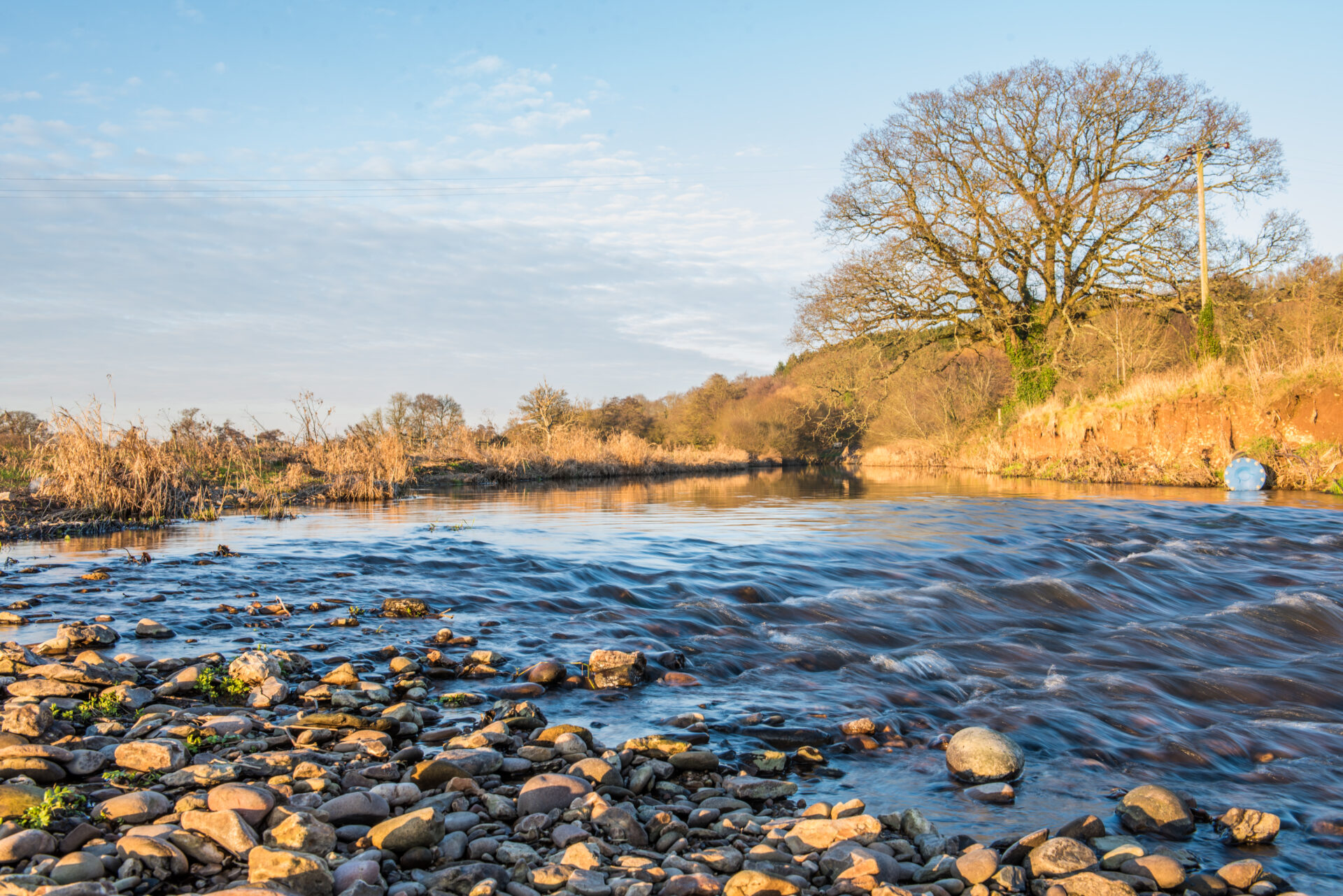
6.Just past Court Place House turn right, then through a gate on to the footpath towards the River Otter.
A short diversion south into Newton Poppleford will give you access to pubs, shops toilets and local services.
Go over the bridge and straight on, away from the river, across the field. The field before the woodland copse can get boggy, after wet weather so, to avoid this, walk to the left or right avoiding the centre of the field.
Pass through a gate at the trees and turn right and then, almost immediately, left up 24 steps and by orchards along a woodland track, taking a left then immediately a right turn at a hedgerow.
Eventually walk downhill at a field edge to reach a lane at the bottom. Turn left then immediately right along the lane signposted to Southerton (SY 076 903).
7. At the end of this lane turn left along the footpath opposite a house named Badgers Hill.
Continue up steps and turn right over a stile where the path now has a wire fence on either side. When you reach a wider track, turn right through woodland and go though a gate to enter Hunger Hill which has conservation grazing.
The landscape has changed dramatically as we are now going over heathland and wide open spaces. As you approach a close-boarded fence follow it left to reach a gate and exit the heathland. Go left on to a lane past thatched cottage called Benchams.
After 100 yards turn left along a footpath through a gate on to the Pebblebed Heaths of Clinton Devon Estates, with conservation grazing. Follow the pebbled track with fields on your right leading down to a stream which you cross by a footbridge.
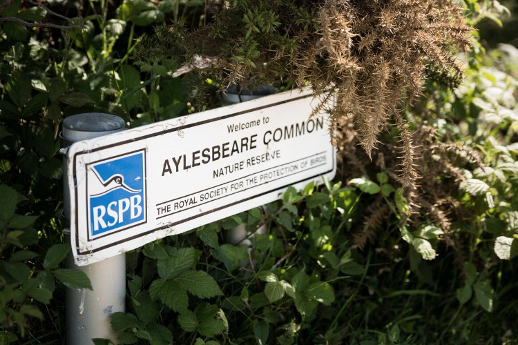
Then continue uphill on the pebble track, though a gate and cattle grid until the track becomes a surfaced roadway. Continue on this roadway through Aylesbeare Common RSPB Nature Reserve where, just before reaching the main A3052 road, is an information board.
Take care crossing this busy road with fast-moving traffic to reach the car park, known as Joney’s Cross, diagonally left opposite.