Embark on your adventure starting from the historic site of Woodbury Castle, an ancient hillfort steeped in heritage.
Take a leisurely walk passing Blackhill Quarry and crossing the peaceful Lympstone Common, a lovely wooded area. Along the way, take in the impressive architecture of A la Ronde, a unique property managed by the National Trust. Your journey ends at the Exmouth Estuary, one of the biggest Local Nature Reserves in Devon.
Additional Information
Additional Information Subtitle
![]()
The whole of the East Devon Way has been waymarked with the foxglove/ pink arrow markers to help you find your way.
Gallery

Quick view route description:
1.Starting at Woodbury Castle...
follow the fingerpost to Exmouth on the south side of the car park and take the track south, keeping the A3180 road on your right.
(The East Devon Way here differs from the route shown on OS maps which have not yet been amended following a route realignment). Go straight over a lane into a car park near Four Firs crossroads (on your right you will see a large B3180 road sign).
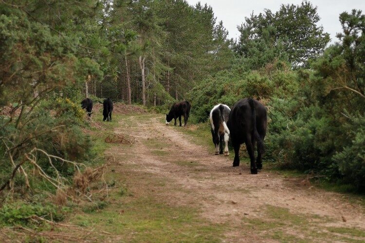
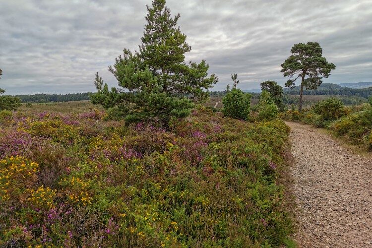
Turn right in this car park through a wooden gate into an area of conservation grazing, following the path through the heathland. Bear right and follow the track uphill aiming for the gap in the conifers on the brow of the hill.
2. After the conifers...
where the track swings left go straight ahead down a narrow pebble path through the gorse towards Blackhill Quarry.
This is an amazing landscape of quarried red sand and gravel, being managed by the RSPB with grazing ponies, The landscape will change significantly over the coming years reverting back to heathland.
Pass a lake on your right and join a broader track. Follow the waymarkers and go through a gate, ascending towards woodland.
3. Turn right at the top (SY 036 851), near Frying pans on the map, then fork left at the waymark post.
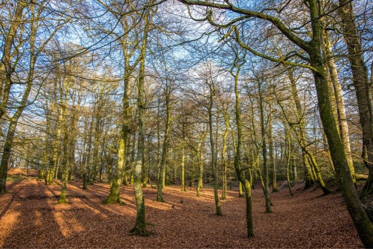
Pass through a wooden gate and enter Lympstone Common. Keep straight ahead where you join a public bridleway. When you reach a crossroads of public bridleways, turn left. Follow the waymarks though the pleasant woodland until you reach a car park, where turn right on to the lane towards the B3179 road..
4.Turn left along the B3179 / B3180 walking along it for 80 yards, then turn right down Higher Marley Road.
This is a narrow residential road with no pavement, Bystock Woods is to your left. At the bottom where the road curves to left, keep straight on Marley Road, ignoring Gorse Lane on the left.
Continue between iron bollards on to a traffic-free section to reach a road: Dinan Way.
5. Cross over this road via a pedestrian refuge to continue down Marley Road which is again closed to vehicles.
Pass houses and, when the road becomes open to vehicles again with houses on both sides, fork right ahead by a waymark post up a wooded track.
Cross over another road (Hulhum Rd), bearing slightly right and turn down a grassy public footpath with houses on the left and fields on the right.
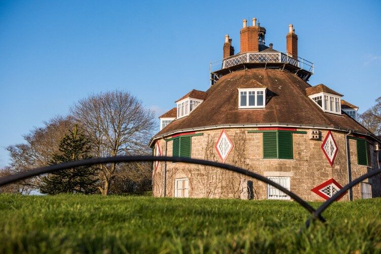
6. When you reach Summer Lane turn left to pass A La Ronde on your left, a unique 16-sided National Trust property.
Members and paying visitors can visit the house, enjoy the views over the estuary and visit the tea room.
Continue on the lane with views ahead to the estuary where you will soon be walking. At the cross roads, go straight over the A376 Exeter Road. Here, there is a petrol station where you can buy refreshments.g).
Alternative route option here, avoiding the fringes of Lympstone Village and reducing the length of this stage by about a mile: Turn left along Exeter Road road until, at a pedestrian crossing/a gap in the houses on your right, you come to a cycle path and footpath link signposted to Little Halsdon Farm. • Walk along this path for ½ mile to join NCN Route 2 just north of the farm. • Turn left and follow the cycle path and footpath along the estuary (as described at Little Halsdon Farm in Step 7 below.)
6. cont...Walk down Courtlands Lane and, after the last house on the right, turn right over a stile along a public footpath.
Walk between a hedgerow on your right and an earth bank on your left and follow it left around the field. Cross a stile and resume walking in the same direction, with the hedge now on your left.
Follow the path as it turns right around the field and then left across a stile, glimpsing the view down to the estuary. Cross another stile onto an access track and at the lane cross over on to a public bridleway. This turns left before meeting a lane (SX994837). Turn right and continue until you see a railway arch over the road.
7. Just before the arch turn left though a gate to follow the Exe Estuary Trail for ¾ mile, a shared cycle route and footpath, part of National Cycle Network Route 2.
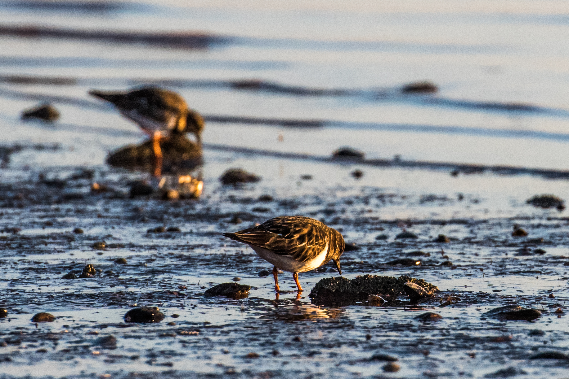
As the path climbs a little you see the estuary on your right, a paradise for bird watching.
Ahead you can see the landmark of Exmouth church tower. After ½ mile you pass National Trust-owned
Lower Halsdon Farm and join Mudbank Lane. Follow it right as it crosses a bridge over a drainage channel.
Turn right at the public footpath sign into a park, then turn right up steps to cross the railway tracks, taking care to look out for approaching trains. Go through a kissing gate, then left at the junction to follow the path along the estuary.
After passing through a pleasant grassy nature reserve, you emerge and pass a coach park then a car park on your left. Follow the road beside the estuary until you arrive at a viewpoint with interpretation boards marking the western end of the East Devon Way.
Alternative route at Step 7: As an alternative to following the broad cycle path, at the railway arch continue under it then immediately turn left on to a public footpath. Follow this path next to the estuary for ½ mile until the path swings left to cross the railway tracks (taking care to look out for approaching trains), then swings right between the railway and above the cycle path.
Eventually this path rejoins the cycle path, then continue from Lower Halsdon Farm, as described in step 7 above.